Excertos do catálogo
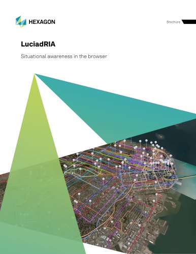
LuciadRIA Situational awareness in the browser
Abrir o catálogo na página 1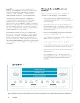
LuciadRIA is the answer to the growing demand for powerful, lightweight applications in the browser. Driven by technologies including Web Assembly, Javascript, Typescript, WebGL and HTML 5, LuciadRIA delivers desktop-like performance for your web applications. Who needs the LuciadRIA browser solution? Developers can create interactive C2 and location intelligence applications thanks to the clean design, modular structure and powerful visual analytics capabilities that can be plugged in. Using its configurable SDK, you can add support for custom data feeds, add your own symbology or match...
Abrir o catálogo na página 2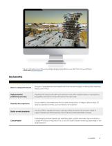
Figure 2: Add realism to your 3D scene by adding shading and visual effects to your data. To try it out yourself, take a look at these LuciadRIA samples. Best-in-class performance Enjoy an unprecedented user experience driven by technologies including Web Assembly, WebGL and HTML5 High geospatial positioning accuracy Visualize and interact with data with precision, even after transformation or reprojection; all geodetic calculations are performed on the client side Desktop-like experience Enjoy a desktop-like experience that includes visualization of imagery, feature data, 3D data and...
Abrir o catálogo na página 3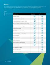
Overview The LuciadRIA components have been organized into product tiers. Depending on the needs of your organization, you can opt for LuciadRIA Essential or Pro. With the Pro tier, you can optionally add support for defense symbology. Legend Feature included Optional feature Functionality Core GIS engine Geospatial reference models Transformation and projection engine 4D cartesian and geodesic geometry model GPU 2D/3D visualization engine Customizable styling 2D/3D/4D interaction model Vertical, profile and timeline views Visual analytics Raster connectors Vector connectors Point clouds...
Abrir o catálogo na página 4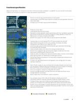
Functional specification Below is a high-level, non-exhaustive overview of the functionality available in LuciadRIA. You can use the functionality it offers out of the box or extend it to meet user-specific requirements. Core GIS engine Geospatial reference models Transformation and projection engine Perform on-the-fly map transformations in the browser Visualize data in any EPSG map projection; visualize accurate geodetic lines and warp raster data Configure your 2D map to pan across the dateline E P 4D cartesian and geodesic geometry model E P GPU 2D/3D visualization engine Customizable...
Abrir o catálogo na página 5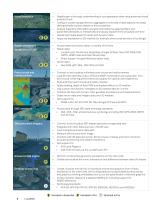
Visual analytics Vector connectors E P Point clouds and reality meshes Connect to and visualize 360-degree panoramic image data sets Integrate with other data sources in the 3D view Load multiple panoramic data sets Measure off the panoramic image Combine with 3D data like terrain, 3D structures, meshes and point clouds for accurate positioning and realistic transitions Get support for: • E57, Leica Pegasus • Add other formats via the LuciadFusion API Perform constructive geometry calculations on the client side Create and visualize the union, intersection and difference between (sets of)...
Abrir o catálogo na página 6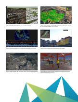
Figure 3: Visually comparing layers with the swipe controller Figure 4: Streaming and visualizing high-resolution terrain with the result of an LOS calculation draped over the terrain Figure 5: Visualizing the density of earthquake events with time filtering Figure 6: Performing accurate measurements of 3D imagery Figure 7: Model, visualize, edit and create military icons and tactical graphics. Figure 8: Monitor editable building information through selection and expression-based styling on 3D data.
Abrir o catálogo na página 7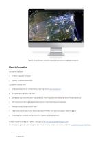
Figure 9: Attract the user’s attention by using bloom effects to highlight airspaces. More information LuciadRIA requires: • LuciadRIA comes with: • Code samples for all components, running live on dev.luciad.com A convenient sample launcher Developer guides with clear explanations, how-to guides and descriptions of best practices API reference offering detailed description of all interfaces and classes Release notes to see what’s new Technical notes describing technical requirements and device support reporting tool A declaration file and instructions for TypeScript development To learn...
Abrir o catálogo na página 8
Hexagon is the global leader in digital reality solutions, combining sensor, software and autonomous technologies. We are putting data to work to boost efficiency, productivity, quality and safety across industrial, manufacturing, infrastructure, public sector and mobility applications. Our technologies are shaping production and people-related ecosystems to become increasingly connected and autonomous – ensuring a scalable, sustainable future. Hexagon’s Safety, Infrastructure & Geospatial division improves the resilience and sustainability of the world’s critical services and...
Abrir o catálogo na página 9Todos os catálogos e folhetos técnicos HEXAGON METROLOGY SAS
-
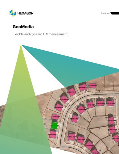
GeoMedia
12 Páginas
-
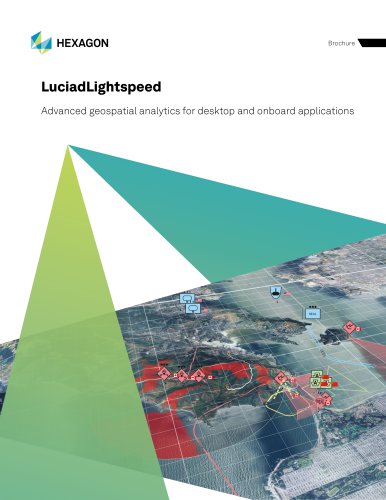
LuciadLightspeed
12 Páginas
-
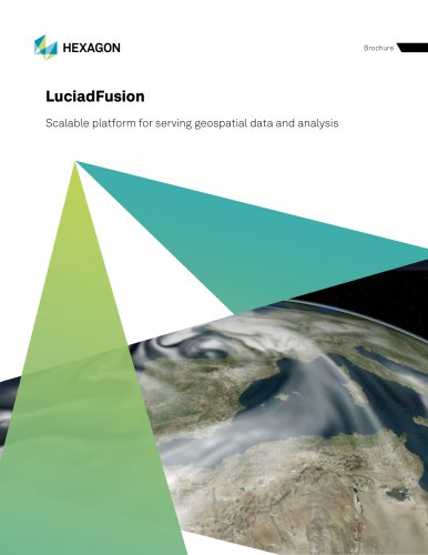
LuciadFusion
14 Páginas
Catálogos arquivados
-
Leitz PMM-C
16 Páginas
-
AT960
2 Páginas

