- Catalogs
- Trakka Systems
- TrakkaMaps TM-100
- Company
- Products
- Catalogs
- News & Trends
- Exhibitions
TrakkaMaps TM-100

TrakkaMaps TM-100
The TrakkaMaps TM-100 is an advanced mission mapping and video management system designed to integrate seamlessly with Trakka's camera and searchlight systems, providing a comprehensive Total Mission Solution.
- Augmented Reality (AR) overlays display geographic information on live video for enhanced mission safety and effectiveness.
- Supports 3D, Street, Satellite, and Custom Map Views.
- Includes video and audio recording with metadata.
- Integrates with open-source and proprietary secure databases.
- Interfaces with networked information sources like vehicle tracking systems.
- Offers unique post-processing capabilities for efficient analysis and reporting.
- Real-time mapping capabilities comparable to competitors.
- Intuitive touch-screen controls compatible with tablets and notebooks.
- Full camera and searchlight functionality from the mapping system.
- Single-click operations for diverse mission challenges.
- Cost-effective, full-featured mapping solution.
- Plug & Play integration with other Trakka products.
- Runs on various computer platforms, including ruggedized laptops.
- Tools for mission planning, playback, analysis, and reporting.
- AR map overlays for enhanced situational awareness.
- Camera and searchlight control for reduced operator workload.
- Easy integration to downlinks via H.264 video streaming.
- Simultaneous exploitation of primary and secondary sensors.
- Views: Street overlay, Map only, Split-screen, Picture-In-Picture, Map/sensor blending.
- Displayed Information: Sensor symbology, compass rose, date/time, aircraft/sensor positions.
- Search: Address look-up, free-text, intersection, city name, coordinates.
- Control: Geo-point, slew-to-pin, searchlight control.
- Recording: Video, audio, metadata.
- Recording compliant with MISB0601.
- Includes continent-wide street maps and elevation data.
- 3D map with multiple follow modes and AR with digital zoom.
- Supports split, PiP, map-only, and video-only screens.
- Operates on Windows OS and customizable to customer requirements.
Catalog excerpts
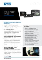
CRITICAL VISION TECHNOLOGY TrakkaMaps®TM-100ADVANCED MISSION MAPPING & VIDEO MANAGEMENTTrakkaMaps TM-100 mission mapping and videomanagement system perfectly complements Trakka’ssuite of advanced camera and searchlight systems for anunparalleled integrated Total Mission Solution.FULL FEATURED MAPPING • Augmented Reality (AR) overlays on live video imagery display important geographic information like roads, boundaries, and Points of Interest for safer and more effective missions • 3D, Street, Satellite and Custom Map Views • Video (with Metadata) and audio recording FLEXIBLE ARCHITECTURE, EASILY CUSTOMISED • Fully integrated with Open Source databases • Easy integration by users with proprietary secure databases • Easily interfaced to networked info sources such as vehicle tracking systems, parcel data etc INNOVATIVE POST-PROCESSING CAPABILITY • Unique post-processing capability for analysis & highly efficient reporting • Real-time mapping capability to match other competitors INTUITIVE USER CONTROL, & MAX SITUATIONAL AWARENESS • Simple touch-screen controls (runs on tablets or notebooks) • Full camera and searchlight functionality from mapping system • Easy single-click operation to meet diverse mission challenges (toggle map layers, move viewpoint, point the camera at a known position etc) • Low-Cost, Full-Featured Mapping Solution • Plug & Play integration with other Trakka products • Runs on a variety of computer platforms, including notebooks and ruggedized laptops • Provides tools for mission planning and post-mission playback, analysis, and reporting • Augmented Reality (AI) map overlays on live video for enhanced situational awareness and accuracy • Slaves camera and searchlight to anywhere on the map for reduced sensor operator workload • Controls the gimbal and sensors for simplified operation and increased safety • Provides easy integration to downlinks via embedded H.264 video streaming over Ethernet (MISB 0601.7 Compliant) • Exploit details from primary and secondary sensors simultaneously via map, video, split-screen, picture-inpicture, and image blending modes
Open the catalog to page 1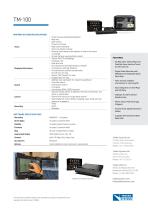
TM-100 MAPPING SYSTEM SPECIFICATIONS • Street overlay (Augmented Reality) Views • Map/sensor blending • Points-of-interest overlay • Reverse Geo-Coding (view address of where the sensor is looking) • Virtual Camera view (synthetic vision) • Sensor Pan/Tilt symbology • Compass rose • Aircraft/sensor boresight position, altitude Displayed Information • Pin positions, altitude, distance • Aircraft/sensor position breadcrumbs • Address look-up (search for location by address) • Free-Text search Search • Intersection search • City Name, • Coordinates (DMS, DDEG formats) • Geo-point (slew sensor to...
Open the catalog to page 2All Trakka Systems catalogs and technical brochures
 TrakkaStream
2 Pages
 TrakkaBeam M800
2 Pages
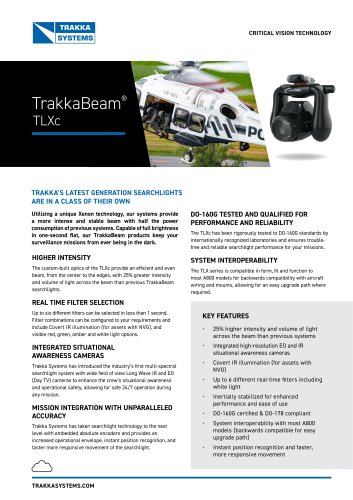 TrakkaBeam TLXc
2 Pages
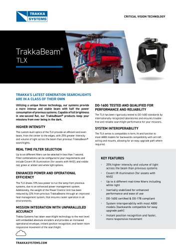 TrakkaBeam TLX
2 Pages
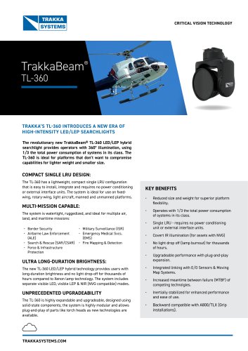 TrakkaBeam TL360
2 Pages
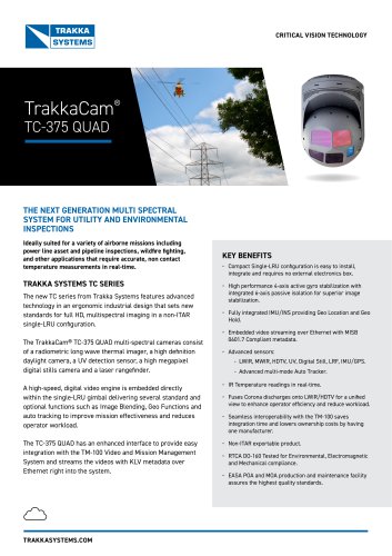 TrakkaCam TC-375-QUAD
1 Page
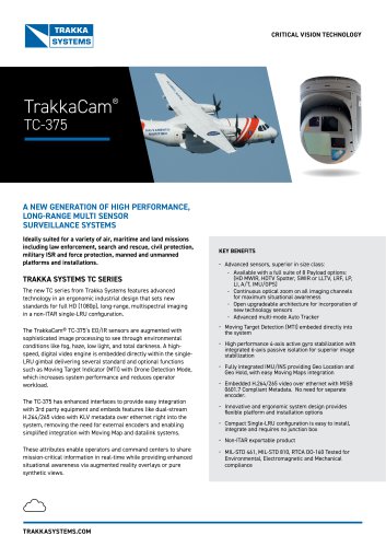 TrakkaCam TC-375
2 Pages
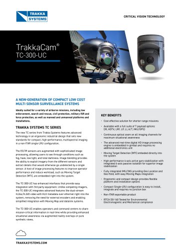 TrakkaCam TC-300-UC
2 Pages
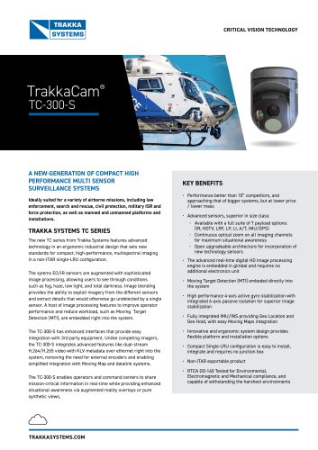 TrakkaCam TC-300-S
2 Pages
 Trakka Cam TC-300 SWIR
2 Pages
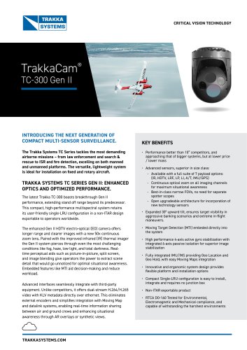 TrakkaCam TC-300 Gen II
2 Pages