
- Catalogs
- SwissDrones Operation AG
- Leica RCD30 for UAV Flyer


Leica RCD30 for UAV Flyer

Leica RCD30 for UAV Flyer
The document discusses the growing demand for UAV-based mapping solutions, highlighting the collaboration between Leica Geosystems and Swissdrones. This partnership offers a reliable and certified solution using the Leica RCD30 camera and Swissdrones Dragon UAV, providing accurate geospatial information within a proven workflow environment.
The Leica RCD30 is a medium format camera known for its high accuracy and multispectral imagery capabilities. It is designed for standalone or oblique mapping and can be integrated with LiDAR sensors. The camera is suitable for use with UAVs like the Swissdrones Dragon, making it ideal for local mapping, corridor applications, mining, and agriculture.
The Swissdrones Dragon UAV comes in two models: Dragon 35 and Dragon 50. Both feature a Flettner Dual Rotor system, with the Dragon 35 using a petrol engine and the Dragon 50 using a diesel/jet engine. Key specifications include:
- Payload capacity: 35 kg for Dragon 35, 50 kg for Dragon 50
- Maximum takeoff weight: 72 kg for Dragon 35, 85 kg for Dragon 50
- Endurance: Up to 4 hours depending on configuration and payload
- Maximum airspeed: 100 km/h
- Service ceiling: 1500m AGL / 3000 MSL
The CGS is a portable unit weighing 25 kg, equipped with two monitors and various control features. It supports a temperature range from -10°C to +70°C and includes redundant power supply for up to 3 hours of battery use.
The UAV features an advanced autopilot system with capabilities such as auto-start, auto-landing, and mission flight. It includes GPS/inertial navigation, data logging, and telemetry, with a positional accuracy of 1.8m RMS.
The Leica RCD30 camera offers high-resolution imagery with CCD sizes of 60MP and 80MP. It features a dynamic range of 73 dB, mechanical motion compensation, and a spectral range covering RGB and NIR. The camera is designed for high accuracy performance between -10°C and +30°C.
The camera complies with various standards including RTCA DO-160G, EUROCAE-14E, and FCC Part 15, ensuring its reliability and safety in diverse operational environments.
Catalog excerpts
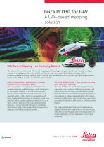
Leica RCD30 for UAV A UAV-based mapping solution UAV-based Mapping – an Emerging Market The demand for professional UAV-based mapping solutions is growing world-wide and new technologies emerge at a rapid pace. The Leica RCD30 medium format camera and Swissdrones Dragon offer a professional UAV mapping solution that is reliable and certified, provides accurate geospatial information and is embedded in an proven workflow environment. Leica Geosystems and Swissdrones – working together for Innovation and Safety Leica Geosystems, the leading provider of airborne mapping solutions, and Swissdrones, a UAV manufacturer, are working together to provide innovative UAVbased mapping and monitoring solutions that can be operated safely in often harsh environmental conditions. The Swissdrones Dragon is a mid-size rotary wing UAV that offers supreme payload performance of up to 50 kg, extreme endurance and a multitude of safety features. It can be operated manually or completely autonomous using proven autopilot technology that is capable of controlling UAV and payload. The Leica RCD30 for UAV – high accuracy mapping from UAV-based platforms The Leica RCD30 is the world’s first medium format camera to provide superior multispectral imagery and highest accuracy. Its unique photogrammetric design features make the Leica RCD30 the preferred choice as a standalone or oblique mapping solution, for integration with a LiDAR sensor and for operation onboard an unmanned aerial vehicle (UAV) such as the Swissdrones Dragon. The unique performance features of the Swissdrones Dragon combined with the qualities of the Leica RCD30 make this an ideal mapping and monitoring solution for local mapping jobs, corridor applications, mining and agric
Open the catalog to page 1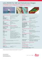
Leica RCD30 for UAV and Swissdrones Dragon A flexible and integrated mapping solution. Mapping, Monitoring, Agriculture End-to-end Workflow © Fugro Spatial Solutions Pty Ltd Swissdrones Dragon with crop sprayer High res orthophotos in RGB and FCIR taken by Leica RCD30 – digital surface model from aerial imagery Swissdrones Dragon 35 UAV – Performance Specifications Rotor Engine Fuel Dimensions L x H x W Empty weight Payload Capacity Maximum take off weight Integrataed autopilot system, rectifier, charge controller and three voltage regulators for extern voltage supplies. Flettner Dual Rotor...
Open the catalog to page 2All SwissDrones Operation AG catalogs and technical brochures
 SDO 50 V2 FOR TRANSPORT
2 Pages
 SDO 50 V2 VTOL
2 Pages
 SDO Flyer
2 Pages
