
- Catalogs
- RAYMETRICS SA
- 3D Aerosol LIDAR


3D Aerosol LIDAR
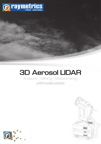
3D Aerosol LIDAR
Raymetrics' 3D Scanning Aerosol LIDAR, model LR111-ESS-D200, is a sophisticated laser remote sensing instrument designed to provide detailed atmospheric information. It is particularly useful for applications such as remote visibility, fog detection, and cloud base height measurement.
Key Features
- High energy laser emitting ~30 mJ per pulse at 355 nm.
- Large 200 mm telescope for enhanced signal capture.
- Range of 10-15 km with excellent Signal to Noise Ratio.
- Remotely controllable with full scanning capability.
- Comprehensive software suite for real-time display and measurement scheduling.
- Options for nitrogen Raman at 387nm and Cross-Polarization at 355nm.
- Eye-safe according to EU standard EN 60825-1: 2007.
- Complies with ISO 28902-1:2012 for visual ranging with LIDAR.
How LIDARs Work
The system emits an eye-safe laser beam into the atmosphere. Light is scattered by atmospheric particles and returned to a telescope, allowing the determination of atmospheric layer distances and characteristics.
Software
- Instrument Control
- Measurement Scheduling
- Alignment and Set-up Procedure
- Data Acquisition and Storage
- Advanced Analysis and 3D Data Visualization
Hardware
- Climate-controlled LIDAR Head
- 3D rotation device for full scanning
- Lockable doors and castors for mobility
Why Raymetrics?
- Experience: Operating since 2002 with a global reach.
- Reputation: Trusted by prestigious organizations like the European Space Agency and Meteo France.
- Power: Uses high energy-per-pulse lasers for greater range and data quality.
- Size: Larger telescopes for more signal capture.
- Standards: Complies with ISO 28902-1:2012 and ISO 9001:2008.
Applications
- Remote Visibility: SVR, RVR, VOR
- Fog Detection: Detects incoming fog banks.
- 3D Cloud Base: Provides remote cloud base and total cloud cover in 3D.
- Volcanic Ash: Identifies volcanic ash and altitudes of ash layers.
- Aerosol Monitoring: Distinguishes between different particle types.
Specifications
- Emitter: 30mJ per pulse at 355nm, 20 Hz repetition rate.
- Receiver: 200 mm primary mirror, adjustable field of view.
- Detection Unit: 355 nm co-polar, options for cross-polar and nitrogen Raman.
- General: 3600 azimuth, 900 zenith scanning, industrial-grade PC.
- Additional: Effective range >10-15 km, environmental tolerance -15 to +45°C.
Contact Information
Raymetrics S.A., 32 Spartis, Metamorfosis 14452, Athens, Greece. Phone: +30 210 6655860, Fax: +30 210 2827217, Website: www.raymetrics.com, Email: [email protected]
Catalog excerpts

3D Aerosol LIDAR Aviation | Mining | Meteorology LR111-ESS-D200
Open the catalog to page 1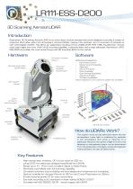
LR111-ESS-D200 3D Scanning Aerosol LIDAR Introduction Raymetrics’ 3D Scanning Aerosol LIDAR is an active laser remote sensing instrument designed to provide a variety of important information about the atmosphere. Aerosol LIDARs measure the particles, not of movement of particles as with wind Doppler LIDARs. This allows for applications including remote visibility (SVR, RVR, VOR), fog detection, remote cloud base height and more. With full 3D scanning capability, a powerful laser and a large telescope, Raymetrics’ LR111ESS-D200 is probably the most powerful eye-safe 3D scanning LIDAR on the market....
Open the catalog to page 2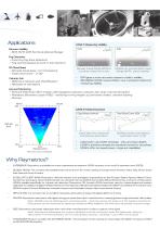
CASE 1: Measuring Visibility RVR Remote Visibility • SVR, RVR, VOR (Vertical Optical Range) Fog Detection • Incoming fog bank detection • Fog cannot bypass as with in-situ sensors 3D Cloud Base • Remote cloud base - for forecasting • Total cloud cover - in 3D Runway Visual Range (RVR) is currently measured in-situ Volcanic Ash • Definitive volcanic ash identification • Altitudes of ash layers LIDARs can provide Slant Visual Range (SVR) - pilot’s visibility SVR gives a more accurate measure of pilot’s visibility ISO 28902-1:2012 means LIDAR is now a standard method of measuring visibility Aerosol...
Open the catalog to page 3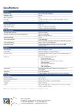
*Effective ranges depend on atmospheric conditions and integration times. Raymetrics S.A. 32 Spartis, Metamorfosis 14452, Athens, Greece T +30 210 6655860 F +30 210 2827217 ■ www.raymetrics.com [email protected]
Open the catalog to page 4All RAYMETRICS SA catalogs and technical brochures
 Raymetrics-Aviation Presentation
15 Pages
 Aerosol LIDAR
3 Pages
 customized LIDARs
5 Pages