- Catalogs
- Phoenix LiDAR Systems
- SCOUT ULTRA
SCOUT ULTRA

SCOUT ULTRA
- General Mapping
- Construction Site Surveying
- Utilities Mapping
- Agriculture & Forestry Monitoring
- Oil & Gas Surveying
- Railway Track Mapping
- Open Pit Mining Operations
The SCOUT ULTRA is the most advanced sensor in the SCOUT Series, designed for efficient data collection in challenging areas. It is lightweight, long-range, and customizable with options like photogrammetry, hyperspectral, and thermal imaging.
- Live Data Feed: Real-time data viewing and analysis.
- Remote Data View: Transmit data via 4G connection.
- Acquisition Upgrades: Includes dual LiDAR sensors, high-res DSLR, RGB GigE Cam, and more.
- Dimensions: Sensor - 18.5 x 11.6 x 11.6 cm; Nav Box - 9.8 x 11.6 x 11.6 cm
- Operating Voltage: 12 - 28 V
- Power Consumption: ~50 W
- Operating Temperature: -10° to +40° C
- Weight: 2.2 kg (including Nav Box)
- Laser Properties: 905 nm Class 1 (eye safe)
- Number of Lasers: 32
- Range: 1.0 m to 200 m with 4 mm resolution
- Max Measurement Rate: 600,000 measurements per second
- Field of View: Horizontal 360°, Vertical 40° (-25° to +15°)
- Accuracy: Up to ±3 cm
- Sensor Classification: IP67
- Constellation Support: GPS, GLONASS, BEIDOU, GALILEO
- Support Alignment: Kinematic, Single-Antenna
- Operation Modes: Real-time, with optional post-processing
- Accuracy Position: 1 cm + 1 ppm RMS horizontal
Phoenix LiDAR Systems offers a comprehensive software suite for mission planning, data acquisition, georeferencing, and export. Key tools include:
- PLS SpatialExplorer: Enables in-field QA/QC and creates colorized point clouds.
- PLS SpatialLighthouse: Streams real-time corrections for RTK trajectories.
- LiDARMill: Cloud-based post-processing platform for efficient data handling.
- Real-time point cloud visualization via 4G or Wi-Fi.
- Designed for various platforms including multi-rotors, cars, and backpacks.
- Analyze LiDAR penetration and measure positions during scanning.
For more information or to explore a Phoenix LiDAR System for your team, visit PhoenixLiDAR.com or contact [email protected].
Catalog excerpts

SCOUT ULTRA The SCOUT ULTRA is the most powerful member of the SCOUT Series. Lightweight and long range, this sensor enables efficient data collection for challenging areas at higher altitudes and speeds. An excellent option for building high-density point clouds, customize your SCOUT ULTRA with photogrammetry, hyperspectral, thermal imaging, and additional options. FEATURES » Live Data Feed: View/analyze data in real time » emote Data View: Transmit live data to R remote viewers via 4G connection » cquisition Upgrades: Dual LiDAR Sensors; A High-Res DSLR; RGB GigE Cam; thermal, hyperspectral cameras; panoramic/spherical cameras; and more QUICK SPECS Absolute Accuracy 55 mm RMSE @ 50 m Range PP Attitude Heading RMS Error 0.019 / 0.074° IMU options Weight 2.2kg / 4.9 lbs. Dimensions 18.5 x 11.6 x 11.6 (cm) PLATFORM OVERALL DIMENSIONS (Sensor) OVERALL DIMENSIONS (Nav Box) OPERATING VOLTAGE POWER CONSUMPTION OPERATING TEMPERATURE WEIGHT (incl. Nav Box) LiDAR SENSOR Laser Range 220 m @ 60% Reflectivity LASER PROPERTIES Scan Rate 600 k points/s, up to 2 returns MAX EFFECTIVE MEASUREMENT RATE HORIZONTAL FIELD OF VIEW VERTICAL FIELD OF VIEW SENSOR CLASSIFICATION LASER BEAM FOOTPRINT H x V » Utilities Mapping » Railway Track Mapping » Agriculture & Forestry Monitoring » Construction Site Surveying » Open Pit Mining Operations » General Mapping NAVIGATION SYSTEM CONSTELLATION SUPPORT SUPPORT ALIGNMENT OPERATION MODES ACCURACY POSITION PP ATTITUDE HEADING RMS ERROR GPS + GLONASS + BEIDOU + GALILEO Kinematic, Single-Antenna Real-time, Post-processing optional 1 cm + 1 ppm RMS horizontal 0.019°
Open the catalog to page 1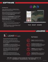
SOFTWARE PLS Software Suite Phoenix LiDAR Systems provides a complete proprietary software suite for streamlined mission planning, acquisition, georeferencing, data fusion & export. Explore the effects that different parameters have on your data before you fly. Estimate your data quality and reduce costs by experimenting with various flight paths, altitudes, and other variables using the Phoenix Flight Planner. Streamline your LiDAR acquisition, georeferencing, data fusion and exporting with: PLS SpatialExplorer to enable in-field QA/ QC and cut down wait-time on extensive photogrammetry applications...
Open the catalog to page 2All Phoenix LiDAR Systems catalogs and technical brochures
 RANGER XL
2 Pages
 RANGER ULTRA
2 Pages
 RANGER-LR LITE
2 Pages
 RANGER-UAV
4 Pages
 RANGER-HA
3 Pages
 RANGER-LR
4 Pages
 SCOUT-32
2 Pages
 SCOUT-16
2 Pages
 SCOUT-8
2 Pages
 RECON-A
2 Pages
 RECON-XT
2 Pages
 miniRanger-3 LITE
2 Pages
 Phoenix UAV LiDAR Systems
20 Pages
- Aeronautical software
- Real-time software
- Process software
- Maintenance software
- 3D software
- Cloud-based software
- Drone software
- Web-based software
- Data acquisition software
- Calculation software
- LIDAR laser
- Drone LIDAR laser
- Mapping LIDAR laser
- Data collection software
- Surveying LIDAR laser
- LIDAR software
- Measurement LIDAR laser
- 3D LIDAR laser
- Viewer software