- Catalogs
- Oxford Technical Solutions Ltd.
- Survey+ brochure
Survey+ brochure
1 /2Pages

Survey+ brochure
1 /2Pages
Catalog excerpts

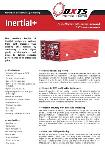
More than Inertial+GNSS positioning Su rvey+ GNSS/INS for land and airborne survey applications Survey+ inertial navigation systems from Oxford Technical Solutions combine the best of GNSS positioning technology with high-grade gyros and accelerometers to deliver superior performance in a single enclosure. » Key features • i cm positioning • 0.03° roll and pitch • Low cost, high accuracy • Tightly coupled GNSS/INS • gx/ix™ technology • Real-time outputs • 100 or 250 Hz versions * Dual antenna versions * GLONASS enabled versions • Smooth, stable outputs • Odometer input • ITAR free • Software suite included • Cables and antennas included » Applications • Aerial photogrammetry • Coastal survey • Topographic mapping • Asset management * GIS data acquisition • Land survey • Road monitoring • Road profiling • Mobile mapping • And more... » Experts in GNSS and inertial technology Advanced algorithms in the Survey+ seamlessly blend the inertial and GNSS data to provide a smooth, real-time 3D navigation solution, even when satellite signals are blocked or disturbed. For ground based applications, a wheel speed odometer can be used to reduce the drift even further. » One box, turnkey solution Combining GNSS receivers, an inertial measurement unit, internal storage and a real-time on-board processor all in one compact box, the Survey+ delivers everything you need for a complete navigation solution. All cables and antennas are included, and the Survey+ comes with an extensive software suite so you can post-process and plot your data at no additional cost. » Simple, adaptable, manageable The Survey+ is easy to install and configure, with simple wizards to speed up the process. It can seamlessly integrate with external sensors such as LIDAR scanners and hyperspectral cameras to provide accurate roll, pitch, and position data for direct georeferencing. All of the components are ITAR free for maximum flexibility when operating in multiple countries. » Improved accuracy with advanced processing A high raw GNSS data rate coupled with processing forwards and backwards in time means post-processed Survey+ data can achieve highest level accuracy. Our custom gx/ix processing engine can further improve performance with single satellite aiding algorithms for position updates even with less than 4 satellites in view. The optional gxRTK feature allows users to download a RINEX file post-mission and process their data
Open the catalog to page 1
Heave accuracy (1a)5 10 cm or 10% 10 cm or 10% 10 cm or 10% 10 cm or 10% » Options: Survey+ABCD A-GNSS receiver B-Constellation Blank: single antenna Blank: GPS only 2: dual antenna G: GPS + GLONASS C-Output rate D-Tracking Ethernet Serial » Hardware 10/100 Base-T 2x configurable RS232 Odometer input Event trigger input iPPS output Camera trigger IMU sync output Input voltage » Sensors Type Technology Accelerometers Gyros Servo MEMS Power consumption 15 W (single antenna) 20 W (dual antenna) Range Optional Operating temperature -io° to 50° C Internal storage...
Open the catalog to page 2All Oxford Technical Solutions Ltd. catalogs and technical brochures
 InertialPlus brochure
2 Pages
 xNAV brochure
2 Pages