- Catalogs
- microdrones
- WORK SMARTER
WORK SMARTER
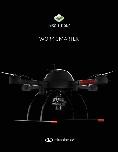
WORK SMARTER
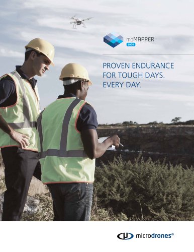
Microdrones provides professional drone packages aimed at enhancing efficiency and accuracy in industrial applications such as surveying, mapping, inspection, construction, mining, volumetrics, and precision agriculture. These packages include UAVs, sensors, accessories, and software for mission planning and analysis.
- mdMapper200: Features the md4-200 UAV for small area mapping, with a payload capacity of 0.6 pounds and a flight time of up to 25 minutes, covering up to 74 acres per battery charge using aerial triangulation with ground control points (GCP).
- mdMapper1000: Utilizes the md4-1000 UAV for larger area mapping, offering a payload capacity of 2.7 pounds and a flight time of up to 45 minutes, covering up to 148 acres per charge with aerial triangulation and GCP.
- mdMapper1000DG: Incorporates direct georeferencing technology, eliminating the need for GCPs, covering up to 198 acres per charge, providing significant time and cost savings with high data accuracy.
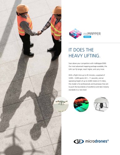
- mdMapper3000DG: The most advanced package with the md4-3000 UAV, capable of carrying up to 11 pounds, featuring a true medium-format camera, supporting direct georeferencing, ideal for corridor mapping.
Microdrones offers accessory kits for thermal mapping, multispectral imaging, and inspection, enhancing the functionality of their UAV solutions.
Direct georeferencing reduces the need for ground control points, lowers sidelap, and increases productivity by covering more ground in less time. It significantly reduces flight and data processing times, as demonstrated in a case study involving a Chilean mining company.
Microdrones successfully demonstrated the mdMapper1000DG's capabilities in a corridor mapping project at a Chilean mine, showcasing the system's efficiency, accuracy, and cost-effectiveness in challenging conditions.
Microdrones is a leader in the UAV industry, offering turn-key solutions for various commercial applications such as surveying, mapping, construction, and agriculture. Known for German engineering, their drones feature long flight times and environmental resilience. Recently, Microdrones expanded into North America and partnered with Trimble to enhance global market service.
Microdrones' mdMapper1000DG and mdMapper3000DG packages utilize direct georeferencing technology, eliminating the need for ground control points (GCPs) and enhancing accuracy and efficiency. These systems integrate advanced sensors and software, allowing for precise data collection and reduced project time.
The mdMapper1000DG includes a robust drone, high-resolution camera, and a GNSS receiver with an IMU for mapping. The mdMapper3000DG offers extended flight times, higher payload capacity, and is suitable for high-altitude operations. Both packages include software for flight planning and data processing.
Microdrones offers various add-ons like +i for aerial inspection, +t for thermal mapping, +m for agricultural analysis, and +LiDAR for point cloud modeling. These accessories enhance the versatility and functionality of their UAV systems.
Microdrones' solutions are used globally to improve efficiency, safety, and accuracy in various industries. Their UAVs are designed to withstand harsh conditions and offer long flight times, making them reliable for professional use.
The drones feature robust carbon fiber construction, a proprietary operating system for customization, and a GNSS receiver for improved positioning. The design ensures stability and efficiency, with failsafe motors and a practical configuration for carrying heavier payloads.
- Compact and lightweight design for easy transport.
- Weather-resistant, allowing operation in rain.
- Flight duration of up to 30 minutes.
- User-friendly for beginners, requiring less than one hour of training.
- Durable construction.
- Best-selling drone with the longest flight times on the market, up to 45 minutes depending on payload.
- Resistant to rough winds, high temperatures, harsh weather, high voltage, and strong magnetic fields.
- User-friendly for beginners, requiring less than one hour of training.
- Durable construction.
- Direct georeferencing capability.
- Can carry a payload up to 11 pounds (approximately 5,000 grams).
- Suitable for LiDAR sensors, professional mapping grade cameras, and multiple sensors.
- Extra-long flight times up to 45 minutes, depending on payload.
- Performs well at high altitudes and in harsh conditions.
- Large sensor footprint allows covering more ground in less time.
- User-friendly for beginners, requiring less than one hour of training.
- Durable construction.
- Direct georeferencing capability.
The document provides a comparison of different drone models, highlighting their unique features and capabilities. It emphasizes ease of use, durability, and specific functionalities like payload capacity and flight duration. For further assistance, potential buyers are encouraged to contact UAV experts for tailored solutions.
Catalog excerpts

WORK SMARTER
Open the catalog to page 1
PROFESSIONAL DRONE PACKAGES At Microdrones, our goal is always to empower you to Your UAV plus everything else you need. In one convenient package. Our mdMapper packages combine industry-leading deliver the best possible work while cutting costs, saving time, and completing projects more easily. mdSolutions were developed with the realities of your job in mind. UAVs with payloads that were specifically designed for industrial applications like surveying, mapping, inspection, construction, mining, volumetrics, and precision agriculture. These packages and kits provide complete solutions that include...
Open the catalog to page 3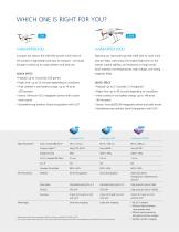
mdMAPPER200 Compact but robust, the md4-200 aircraft at the heart of this solution is lightweight and easy to transport - yet tough enough to stand up to rough weather and daily use. QUICK SPECS • Payload: up to .6 pounds (250 grams) • Flight time: up to 25 minutes depending on conditions • Area covered in one battery charge: up to 74 acres (30 hectares) • Sensor: Minimum 18.2 megapixel camera with custom nadir mount • Georeferencing method: Aerial triangulation with GCP mdMAPPER1000 Featuring our hard-working md4-1000 UAV to cover more area per flight, users enjoy the longest flight time on...
Open the catalog to page 4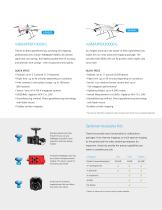
,3000DG, mdMAPPER1000DG Thanks to direct georeferencing, surveying and mapping professionals who choose mdMapper1000DG will achieve significant cost savings, the highest possible level of accuracy, and dramatic time savings - with no ground control points. QUICK SPECS • Payload: up to 2.7 pounds (1.2 kilograms) • Flight time: up to 45 minutes depending on conditions • Area covered in one battery charge: up to 198 acres (80 hectares) • Sensor: Sony rxlrii (42.4-megapixel camera) • GNSS/IMU: Applanix APX-15-L UAV • Georeferencing method: Direct georeferencing technology with Nadir mount • Enables...
Open the catalog to page 5
ADDING OVERHEAD IS NOW AN EASY DECISION. It’s never been easier to make aerial mapping a part of your business. Take your business to a higher level with a professional mapping solution from Microdrones. This basic package has everything you need to complete mapping projects more quickly and accurately, while gaining a competitive edge. Compact but robust, the md4-200 aircraft at the heart of this solution is lightweight and easy to transport – yet tough enough to stand up to rough weather and daily use. mdMapper200 is a reliable, professional solution that will allow you to stay in the air longer...
Open the catalog to page 6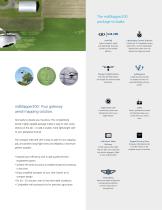
mdMapper200: Your gateway aerial mapping solution. Get ready to elevate your business. This competitively priced, highly capable package makes it easy to start using drones on the job - or add a smaller, more lightweight UAV to your geospatial arsenal. The compact md4-200 UAV is easy to take on any mapping job, yet achieves long flight times and reliability in less-than-perfect weather. • Improve your efficiency with a high-quality German-engineered system. • Achieve the same accuracy as traditional ground surveying in less time. • Enjoy simplified transport of your UAV, thanks to its compact...
Open the catalog to page 7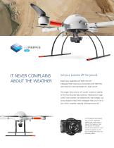
IT NEVER COMPLAINS ABOUT THE WEATHER Get your business off the ground. Expand your capabilities and flight time with mdMapper1000. Featuring our best-selling d4‑1000 UAV, m users enjoy the critical advantages of a larger aircraft. The longest flying time on the market. Impressive stability for the most accurate data collection. Resistance to rough winds, harsh weather, hot temperatures, high voltage, and strong magnetic fields. With mdMapper1000, you’ll rise to your clients’ toughest mapping challenges every time. A 24 megapixel camera paired with a custom, lightweight, vibration-free, nadir...
Open the catalog to page 8
The mdMapper1000 package includes: md4-1000 md4-1000 Robust, powerful, stable and dependable. Build your business on this versatile platform. Sony a6300 & Nadir Mount 24 megapixel camera paired with a custom, lightweight, vibration-free, nadir mount to capture the images you need. Charger & Flight Battery One md4-1000 flight battery and charger for maximum flight endurance. mdWaypoint A flight planning module to prepare and carry out automated flights with your aircraft. mdMapper1000: Do more -even in intermittent conditions. This package is all about resilience, convenience, and all-around performance....
Open the catalog to page 9
NO GROUND CONTROL POINTS, LESS SIDELAP, MORE PRODUCTIVITY. Master your geospatial data by putting direct georeferencing to work for you. With dMapper1000DG, you’ll achieve the m highest level of data accuracy urrently possible using fewer c ground control points – or no ground control points at all. Conquer large projects in a fraction of the time. Meet the most precise data requirements and cover more ground in one flight. mdMapper1000DG will help you deliver unparalleled data quality in less time. A 42.4 megapixel camera paired with a custom, lightweight, vibration-free, nadir mount to...
Open the catalog to page 10
Imagine saving 10 hours per project. Why does direct georeferencing matter in UAV mapping? Calling this solution a game-changer is no exaggeration. The reduced/eliminated need to install ground control points, low sidelap, and industry-leading flight times add up to significant time (and, therefore, cost) savings. Below is an example comparison of a surveying project completed using two different mdMapper packages: mdMapper1000, which uses aerial triangulation, and mdMapper1000DG, which uses direct georeferencing. On the right, less flying is necessary with the Direct Georeferencing (DG) solution,...
Open the catalog to page 11
RAISE YOUR EXPECTATIONS mdMapper1000DG as a corridor mapping tool When a Chilean mine company invited Microdrones to perform a demonstration at one of their sites, the team was eager to show off their newly released mdMapper1000DG solution – and the cost savings, accuracy, efficiency, and safety this direct georeferencing (DG) system achieves. The client challenged the team and the system with a corridor mapping assignment, and both rose to the occasion. MAIN POINTS • A recent corridor mapping project in Chile. • Rough • Were winds, frigid conditions. unexpectedly asked to corridor map. The Microdrones...
Open the catalog to page 12All Microdrones catalogs and technical brochures
 mdMAPPER_Accessories
2 Pages
 mdMAPPER1000DG
4 Pages
 mdMAPPER1000
4 Pages
 mdMAPPER200
4 Pages
 mdMAPPER3000DG
2 Pages