- Catalogs
- microdrones
- mdMAPPER3000DG
mdMAPPER3000DG
mdMAPPER3000DG
- Flight Time: Up to 45 minutes.
- Payload Capacity: 3,000 – 5,000 grams (6.5 – 11 pounds).
- Operating Height: Up to 4,000 meters (2.5 miles).
- Capable of carrying heavy sensors like LiDAR or multiple sensors simultaneously.
- German-engineered for durability in harsh conditions.
- Large sensor footprint for efficient ground coverage.
- md4-3000: A robust and versatile UAV platform.
- Phase One & Nadir Mount: Medium-format camera with 50-100 megapixels.
- Applanix APX-15-L UAV: GNSS receiver and calibrated IMU for precise mapping.
- Charger & Flight Battery: Ensures maximum flight endurance.
- mdWaypoint: Flight planning module for automated missions.
- mdLandingAssistant: Automatic landing system.
- Digital Data Link: Connects UAV to digital devices.
- mdRC: Professional controls and telemetry.
- POSPac UAV: Post-processing software for data accuracy.
- mdCockpit Tablet Software: Android-based flight planning and monitoring.
- Rugged Carrying Case: For transport in tough environments.
- mdAcademy: Training for operation and maintenance.
Catalog excerpts

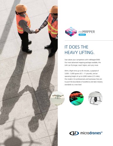
IT DOES THE HEAVY LIFTING. Soar above your competitors with mdMapper3000. Our most advanced mapping package available, this UAV can fly longer, reach higher, and carry more. With a flight time up to 45 minutes, a payload of 3,000 – 5,000 grams (6.5 – 11 pounds), and an operating height of up to 4,000 meters (2.5 miles), this model is for professionals and businesses that aim to push the boundaries of excellence and take industry standards to a new lev
Open the catalog to page 1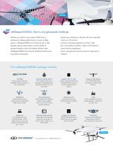
A REVOLUTION IN PAYLOAD FLEXIBILITY. mdMapper3000DG: Rise to any geospatial challenge. Whether you need to carry a heavy LiDAR sensor, a professional mapping grade camera, or even multiple sensors, mdMapper3000DG can handle the job. A high payload capacity, large footprint, and the ability to in the harshest conditions, thanks to Microdrones’ robust German engineering. operate flawlessly at even the highest altitudes make mdMapper3000DG the choice for professionals that want your efficiency on the job with extra long flight more ground in less time due to its large sensor Phase One & Nadir Mount...
Open the catalog to page 2All Microdrones catalogs and technical brochures
 WORK SMARTER
24 Pages
 mdMAPPER_Accessories
2 Pages
 mdMAPPER1000DG
4 Pages
 mdMAPPER1000
4 Pages
 mdMAPPER200
4 Pages