

Q4L

Q4L
The Q4L Remotely Piloted Aircraft System is designed for precision farming and territorial monitoring, offering real-time interaction with ground control through a data link. It provides flexibility with reduced cost and risk, featuring a flight control system for automatic stability, guidance, and navigation.
- Autonomous and remotely piloted flight
- Real-time data link
- Flight data management system
- Wireless video capabilities
- Data logging and telemetry
- Construction: Composite (GF-ABS)
- Size: 980 x 980 x 300 mm
- Weight: 1800 g (< 2000 g)
- Payload: < 300 g
- Range: 250 m to 1000 m
- Endurance: 20 to 25 minutes
- Number of rotors: 4
- Cruise airspeed: 10 m/s (max)
- Vertical take-off and autonomous or radio-controlled landing
- Operating altitude: 70 m above ground level
- Maximum wind tolerance: 20 km/h
- Rain tolerance: Light rain only
- Transport: Backpack or rigid bag
- Power: Li-Po sealed battery pack
- Propulsion: Brushless DC electric motor
- RC receiver range: 750 m (line of sight)
- Wireless transmission range: >300 m (line of sight)
MAVTech s.r.l., a spin-off from Politecnico di Torino, is certified by ENAC as a RPAS Consultant Organization. The company focuses on developing innovative aeronautical solutions for civil applications, including aerial surveillance and operation support. Core activities include the design and production of Remotely Piloted Aircraft Systems, integration with customer applications, and development of control and simulation tools.
Catalog excerpts

Remotely Piloted Aircraft System Q4L Multicopter The Q4L Remotely Piloted Aircraft System has been developed in order to perform data acquisition for precision farming and territorial monitoring, allowing a full interaction with ground control through a real time up and down data link with the aircraft. The advantage of using scaled aerial vehicles is the flexibility with reduced cost and risk. A flight control system (providing automatic stability, guidance and navigation capabilities) is installed on the vehicle and the flight parameters can be evaluated in real time or in post-flight mode. MAVTech srl Corso Galileo Ferraris 57 10128 - Torino (Italy) TIS Innovation Park Via Siemens 19 39100 - Bolzano (Italy) Email: [email protected] Web: www.mavtech.eu Features Autonomous And Remotely Piloted Flight Real-Time “Up And Down” Data Link Flight Data Management System Wireless Video Capabilities Data Logging And Telemetry
Open the catalog to page 1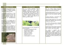
Company ProfileApplication Outline MAVTech s.r.l. was founded as a spinoff company of Politecnico di Torino. The company is a RPAS Consultant Organization certified by ENAC. The potential of MAVTech s.r.l. is the production of technical solutions with competitive performances and costs (including customer support and training of end users) deriving from the development of knowledge-based projects. MAVTech s.r.l. is a company with a primary interest in the development of innovative aeronautical solutions for aerial surveillance and operation support for civil applications. The design and the production...
Open the catalog to page 2All MavTech catalogs and technical brochures
 AGRI 1900
2 Pages
Archived catalogs
 AGRI2000
2 Pages
 AGRI2000 DRONE
2 Pages
 Q4P
Q4P2 Pages
 JavaCube
2 Pages
 MH850
MH8502 Pages