
- Catalogs
- KONGSBERG GEOSPATIAL
- TerraLens Server

TerraLens Server
TerraLens Server
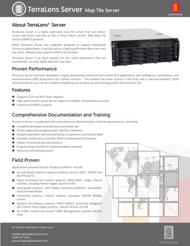
TerraLens Server is a highly optimized map tile server designed to deliver vector and raster map tiles via the Web Map Tile Service (WMTS) protocol. It is suitable for both thin and thick client applications and supports any client software compatible with WMTS tile formats. The server is particularly effective for applications requiring detailed map data.
Proven Performance
TerraLens Server has been successfully deployed in demanding command and control (C2) and intelligence, surveillance, and reconnaissance (ISR) applications, particularly for military analysts. It is well-documented, ensuring quick project initiation with minimal risk.
Features
- Supports TCP and REST data requests
- High-performance server kernel for multiple, simultaneous sessions
- Implements WMTS protocol
Comprehensive Documentation and Training
TerraLens Server offers extensive documentation and training resources, including:
- Developer-oriented documentation
- Online API reference
- Sample applications
- MVC development framework examples
- Map product preview viewer
- Programming tutorials
- Instructor-led training courses
Field Proven Applications
TerraLens Server powers various applications, including:
- Air and Missile Defense systems: Radiant, Sentry, ASOC, THAAD, AN/TPS-6x/7x
- Naval Command and Control systems: CATCC/AATC, Aegis, Littoral Combat, Canadian Patrol Frigate, Spanish F105
- Land-based systems: Joint Battle Command-Platform, Ground/Air Task Oriented Radar
- Unmanned systems: Control stations, including TRITON (BAMS) system
- Airborne Surveillance systems: NATO AWACS, Australian Wedgetail, Turkish Peace Eagle, special mission aircraft
- Air Traffic Control and Vessel Traffic Management systems: Worldwide
For further information, contact [email protected] or call 1-800-267-2626. Visit www.KongsbergGeospatial.com for more details.
Catalog excerpts
TerraLens Server Map Tile Server ok About TerraLens® Server TerraLens Server is a highly optimized map tile server that can deliver vector and raster map tiles to thin or thick clients via the Web Map Tile Service (WMTS) protocol. While TerraLens Server was originally designed to support distributed TerraLens applications, it can be used as a highly performant tile server with any client software that supports WMTS tile formats. TerraLens Server is an ideal solution for thin client applications that are intended for use with highly detailed map data. Proven Performance TerraLens Server has been deployed in highly demanding command and control (C2) applications and intelligence, surveillance, and reconnaissance (ISR) applications for military analysts. This product has been proven in the field, and is well-documented. With TerraLens Server, you can be confident of getting your project up and running quickly with minimal risk. Features • Supports TCP and REST data requests • High-performance server kernel supports multiple, simultaneous sessions • Implements WMTS protocol Comprehensive Documentation and Training TerraLens Server is supported with comprehensive documentation and training resources, including: • Complete developer-oriented documentation set • Online application programmatic interface reference • Sample application demonstrating key components and functionality • Example model-view-controller (MVC) development framework • Viewer for previewing map products • Programming tutorials for implementation concepts • Instructor-led training course Field Proven Applications powered by the TerraLens platform include: • Air and Missile Defense systems: Radiant, Sentry, ASOC, THAAD and AN/TPS-6x/7x • Naval Command and Control systems: CATCC/AATC, Aegis, Littoral Combat, Canadian Patrol Frigate, Spanish F105 • Land-based systems: Joint Battle Command-Platform, Ground/Air Task Oriented Radar • Unmanned systems: Control stations, including TRITON (BAMS) system • Airborne Surveillance systems: NATO AWACS, Australian Wedgetail and Turkish Peace Eagle systems, special mission aircraft • Air Traffic Control and Vessel Traffic Management systems: Worldwide For further information contact us at [email protected] 1-800-267-2626 www.KongsbergGeospatial.c
Open the catalog to page 1All KONGSBERG GEOSPATIAL catalogs and technical brochures
 terralens_mobile
1 Page
 terralens_web
1 Page
 terralens_core
2 Pages