- Catalogs
- HEXAGON METROLOGY SAS
- GeoMedia
GeoMedia

GeoMedia
- Deep analysis capabilities with dynamic result updates.
- Flexible tier and add-on structure for tailored system configuration.
- Creation of intelligent, intuitive maps to unlock data insights.
Catalog excerpts
GeoMedia Flexible and dynamic GIS management
Open the catalog to page 1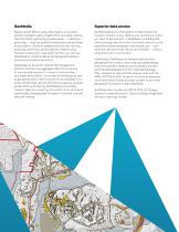
Superior data access Maps present data visually, allowing you to visualize location and gain useful insights from your data. Making the information-gathering process easier — creating a good map — requires powerful analytical tools and clear symbolization. Whether updating land and tax records, analyzing traffic flow and accidents or determining the best locations for evacuation centers, you can use GeoMedia to combine tabular and geographic data to produce actionable information. GeoMedia gives you the freedom to spend less time trying to connect to your data so you can focus on what you want...
Open the catalog to page 2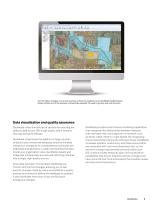
As information changes in your data sources, so does the analysis in your GeoMedia GeoWorkspace. Simply refresh and all the analysis is dynamically updated. No need to go back and redo the work. Data visualization and quality assurance GeoMedia offers a multitude of options for ensuring the data you add to your GIS is high quality and it remains that way during its lifespan. GeoMedia streamlines the addition of large volumes of data to your enterprise database, ensures the data meets your standards for completeness (attributes are populated and geometry is valid) and matches the data model your...
Open the catalog to page 3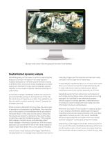
3D data provides context to the other geospatial information inside GeoMedia. Sophisticated, dynamic analysis GeoMedia gives you the power to perform sophisticated analysis to extract information from data stored in multiple databases on different platforms and a variety of different files, all at once. It also enables you to create queries of unlimited intricacy and concatenate queries together so the results of queries feed dynamically into one another. mainstay of agencies that operate and maintain roads, railroads, transit, pipelines or waterways. As the data changes, GeoMedia updates the...
Open the catalog to page 4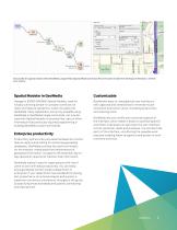
Execute 64-bit spatial models within GeoMedia using the Run Spatial Model command. Rerun the same model from the Explorer Window to refresh your results. Spatial Modeler in GeoMedia Hexagon’s ERDAS IMAGINE Spatial Modeler, used for visually authoring simple-to-complex workflows via raster and feature operations, is also included with GeoMedia. Many capabilities, some only available using GeoMedia or GeoMedia Image commands, can now be used with Spatial Modeler to process files, data or other information that previously required programming or building GeoMedia custom commands. GeoMedia’s easy-to-use...
Open the catalog to page 5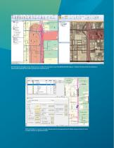
As information changes in your data sources, so does the analysis in your GeoMedia GeoWorkspace. Simply refresh and all the analysis is dynamically updated. No need to go back and redo the work. With GeoMedia it is easy to manage the placement and appearance of labels using a variety of rules in either a static or dynamic format.
Open the catalog to page 6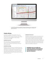
The LRS/MLRS capabilities within GeoMedia Transportation Manager let you join, merge and create location information from many different source references but all managed in one database and within one feature set. Flexible offering GeoMedia is available in three product tiers so you can acquire the specific functionality you need. Tiers make it easy for you to adjust the scope of the software to match your GIS management needs, analysis requirements and budget. GeoMedia Essentials Query and analyze a wide variety of geospatial data sources and formats with GeoMedia Essentials for dynamic, ad...
Open the catalog to page 7
One connected solution GeoMedia connects the entire geospatial Power Portfolio of products for a seamless, complete solution to geo-enable your enterprise. Product and interaction Work on photogrammetry projects directly in GeoMedia with ImageStation Stereo for GeoMedia, ImageStation DTM for GeoMedia, ImageStation OrthoPro and ImageStation PixelQue. Link to a GeoMedia environment from the ERDAS IMAGINE interface to synchronize navigation and Area of Interest. Enhance imagery in ERDAS IMAGINE before bringing it into GeoMedia. Share spatial models between ERDAS IMAGINE and GeoMedia. Move data easily...
Open the catalog to page 8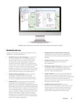
GeoMedia’s ribbon interface can be customized to make it easier to define and share specific workflows. GeoMedia add-ons Hexagon offers additional products to expand the core capabilities of the GeoMedia tiers. • GeoMedia Transportation Manager provides tools to help professionals in municipalities, airports, seaports, departments of transportation (DOTs), rail companies, waterway agencies or pipeline operations efficiently analyze their transportation infrastructure. This includes capabilities for tracking network information and performing specialized analyses. In addition, users can build...
Open the catalog to page 9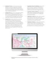
GeoMedia GI Toolkit is a set of productivity tools designed to extend the capabilities of GeoMedia Professional. It supports data and map production workflows, including data collection, data integration and management and data dissemination by meeting industry-specific specifications. GeoMedia PDF allows users to create highly intelligent georeferenced PDF files from map sheets in the layout window of a GeoMedia GeoWorkspace. Users can control characteristics such as order of layers, included attributes, CMYK/RGB output color model and number of exported map sheets to PDF files. GeoMedia VPF...
Open the catalog to page 10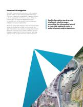
Seamless GIS integration GeoMedia helps you easily unlock and understand the dynamic stream of real-world geospatial information that flows through your organization. It lets you conduct a variety of analyses, from the very simple to the very sophisticated, on data from disparate sources. It connects directly to the spatially enabled databases already in use by your organization. GeoMedia allows deep analysis and dynamically updates results. Its flexible tier and add-on structure let you tailor the system to your specific business requirements. GeoMedia empowers you to create intelligent, intuitive...
Open the catalog to page 11
Hexagon is the global leader in digital reality solutions, combining sensor, software and autonomous technologies. We are putting data to work to boost efficiency, productivity, quality and safety across industrial, manufacturing, infrastructure, public sector, and mobility applications. Our technologies are shaping production and people-related ecosystems to become increasingly connected and autonomous – ensuring a scalable, sustainable future. Hexagon’s Safety, Infrastructure & Geospatial division improves the resilience and sustainability of the world’s critical services and infrastructure....
Open the catalog to page 12All HEXAGON METROLOGY SAS catalogs and technical brochures
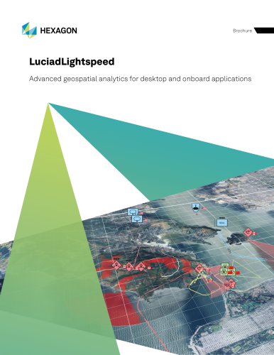 LuciadLightspeed
12 Pages
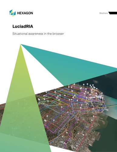 LuciadRIA
9 Pages
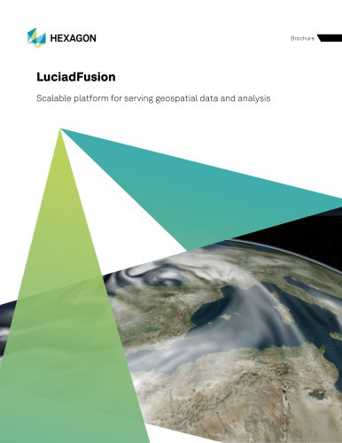 LuciadFusion
14 Pages
Archived catalogs
 Leitz PMM-C
16 Pages
 AT960
AT9602 Pages
- HEXAGON aeronautic software
- HEXAGON real-time software
- HEXAGON process software
- Maintenance software
- 3D software
- Cloud-based software
- HEXAGON measurement software
- 2D software
- Automated software
- Web-based software
- Server software
- Machining software
- Calculation software
- Data collection software
- Inspection software
- Web browser software