- Catalogs
- ENVIRONMENTAL SYSTEMS RESEARCH INSTITUTE, INC.
- ArcGIS Aviation Airports
ArcGIS Aviation Airports

ArcGIS Aviation Airports
ArcGIS Aviation Airports is a comprehensive tool designed to help airports achieve GIS compliance through a ready-to-use data model. It supports the mapping of airfield infrastructure assets, validation against FAA and international standards, and management of obstacle collection and evaluation.
- Produce: Map airfield infrastructure assets to specifications.
- Validate: Ensure compliance with FAA, RTCA, EUROCAE, and ICAO’s eTOD standards.
- Manage: Maintain a comprehensive database for obstacle collection and airfield assets.
- Analyze and Visualize: Visualize assets in 2D and 3D, including signage, markings, and obstacle analysis results.
- Share and Collaborate: Use ArcGIS to publish and share web services for stakeholder engagement and decision-making.
- Safety: Enhance operational safety by ensuring airspace is free of hazardous obstacles.
- Regulatory Compliance: Utilize tools to comply with various regulations and perform preconfigured data checks.
- ROI Maximization: Grow strategically with an enterprise information system that integrates location intelligence.
- Reduce Production Time: Automate tasks like obstacle surface creation and data validation to increase efficiency.
- Informed Decision-Making: Integrate airport assets with GIS for better access to information and insights.
- Enable Collaboration: Foster collaboration between airports and agencies on projects affecting airport surfaces.
ArcGIS Aviation Airports provides a robust framework for building and maintaining authoritative datasets of airport infrastructure, integrating these assets with enterprise GIS, and supporting safe and efficient airport operations.
Catalog excerpts

ArcGIS Aviation Airports ® The Foundation for a Smart Airport Vision What is ArcGIS Aviation Airports? ArcGIS® Aviation Airports provides tools and a data model that deliver the framework for building and maintaining authoritative datasets of airport infrastructure and integrating these assets with your enterprise geographic How does it work? Aviation Airports allows you to easily achieve airport GIS compliance with a ready-to-use data model. information system (GIS). It allows you to reduce Produce: Map airfield infrastructure assets obstruction risk and manage airfield operations while streamlining regulatory reporting. You can create and Validate: Support FAA and international manage Electronic Terrain and Obstacle Data (eTOD) and standards such as RTCA, EUROCAE, and 3D surfaces for airport obstacle analysis, and signs and markings to compare them with reference data to ensure safe operations. Stakeholders can make better-informed decisions using airport basemaps, 3D visualizations, and operations support content. ICAO’s eTOD. Manage: Manage obstacle collection and evaluation as well as airfield assets in a comprehensive database. Analyze and visualize: Visualize in 2D and 3D your assets such as signage and markings and the results of your obstacle analysis. Share and collaborate: Leverage ArcGIS to publish and share web services for stakeholder engagement and improved decision-making. Establish a comprehensive system of record for airport information that forms the basis for business system integration, spatial analysis, and visualization in alignment with the airport’s business objectiv
Open the catalog to page 1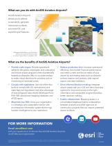
What can you do with ArcGIS Aviation Airports? ArcGIS Aviation Airports allows you to adhere to standards, generate obstruction surfaces, automate QC, and export/import features. Manage airfield data in out-of-the-box schema and use that data to create an airport layout plan or visualize in 3D. What are the benefits of ArcGIS Aviation Airports? ü Provide a safe airport: Provide operational safety for the public, employees, and contractors and ensure airport airspace is free of potentially hazardous obstacles. Rely on accurate analysis to make critical decisions for activities such as monitoring...
Open the catalog to page 2- KENNAMETAL aeronautic software
- KENNAMETAL real-time software
- KENNAMETAL airport software
- KENNAMETAL process software
- Maintenance software
- KENNAMETAL 3D software
- KENNAMETAL cloud software
- KENNAMETAL navigation software
- Measurement software
- Tracking software
- 2D software
- Drone software
- KENNAMETAL mapping software
- Web-based software
- Automated software
- Flight planning software
- Server software
- KENNAMETAL collaborative software
- Image analysis software
- Geolocation software