- Catalogs
- DELAIR-TECH
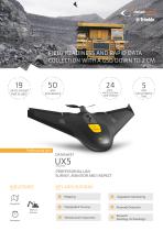
- UX5 PROFESSIONAL UAV SURVEY, MONITOR AND INSPECT
UX5 PROFESSIONAL UAV SURVEY, MONITOR AND INSPECT

UX5 PROFESSIONAL UAV SURVEY, MONITOR AND INSPECT
- Coverage and Endurance: Capable of covering up to 19 km² per flight with an endurance of up to 50 minutes.
- Image Quality: Equipped with a 50 Mpix professional RGB sensor and a 24 Mpix APS-C camera with a custom 15 mm lens for high-quality image acquisition.
- Field Readiness: Designed for rapid deployment with a minimum deployment time of 5 minutes and operational in all-weather conditions.
- Landing Precision: Features reverse thrust for precise landings in confined spaces.
- Data Processing: Compatible with Delair-Stack® and Trimble Business Center for intuitive workflow and data processing.
- Sensor: 24 Mpix mirrorless APS-C with custom lens.
- Operating Conditions: Wind resistance up to 65 km/h, operational ceiling up to 5000 m, and recommended landing space of 50 m x 30 m.
- Physical Attributes: Weighs 2.5 kg with a wingspan of 1 m, constructed from EPP foam, carbon frame, and composite elements.
- Performance: Cruise speed of 80 km/h with a flying range of 60 km.
Catalog excerpts
UX5 PROFESSIONAL UAV SURVEY, MONITOR AND INSPECT INDUSTRIES KEY APPLICATIONS Mines & Quarries
Open the catalog to page 1
Professional line UX5: PROFESSIONAL UAV - SURVEY, MONITOR AND INSPECT Leading image acquisition quality using the 24 Mpix APS-C camera. Field readiness and operational performance: allweather performance, all-terrain technology, high resistance compatible with an intensive use. Landings - less space, more accuracy - reverse thrust for precise landings in confined spacesfor landing confidence every time. Accessible technology & intuitive workflow with Trimble Business Center and/or Delair-Stack® data processing software. Flying range Up to 50 min 2.5 kg 1 m EPP foam; carbon frame structure; composite...
Open the catalog to page 2All DELAIR-TECH catalogs and technical brochures
 Delair UX11
2 Pages
 Sat bear
2 Pages
 Mama bear Antenna
2 Pages
 DT-Eye X
2 Pages
 DT-Eye
2 Pages
 DT-5Bands
2 Pages
 DT-4Bands
2 Pages
 DT-3Bands
2 Pages
 DT26X-PPK
2 Pages
 DT26X-Lidar
2 Pages
 DT18
DT182 Pages
 White-paper-DT18-PPK
15 Pages
 White-paper
10 Pages
 DT26X
DT26X2 Pages
 DT26M
DT26M2 Pages


