
- Catalogs
- CS SOFT A.S.
- ALS CWS


ALS CWS

ALS CWS
- The ALS CWS is a user-friendly module designed for air traffic controllers, offering a comprehensive display of air traffic information.
- It is highly configurable, allowing customization of the human-machine interface (HMI) to meet client needs, including color schemes, display layouts, and electronic strip classifications.
- Users can create and display private maps directly from their workstations using an accessible mapping tool.
- The system utilizes advanced picture processing technologies (OpenGL) for smooth operation on standard PCs without the need for specialized hardware.
- It includes basic tools for evaluating archived data and a tactical tool for identifying potential flight conflicts based on flight plan evaluations.
- The CWS operates independently of the Flight Data Processing (FDP) system, allowing direct entry of flight plans and intercommunication among multiple CWS units without a server.
- In case of system outages, hard copies of electronic strips are available.
- The system supports electronic strip displays with paper alternatives and uses the ASTERIX input format.
- It displays multi-radar surveillance data, including aircraft positions, tracks, and plots, and facilitates hand-off and automatic coordination within the system or with other ATC workstations.
- Flight plan data is displayed, with options for map selection, scaling, and parameter adjustments.
- The system can display surveillance situations in radar windows, with detailed views of selected areas, and includes analogue primary radar and meteorological data.
- The interface is user-friendly and compliant with ICAO standards, resistant to data congestion, and supports communication with FDP and AIS for flight plan and meteorological data management.
- Surveillance information can be automatically or manually coupled with flight plan data, and the system provides warnings from the Safety Nets subsystem.
- It features a replay function for archived data with basic evaluation tools and displays radio-goniometer outputs directly in the view display.
- The system runs on Linux OS.
The ALS CWS provides a structured display of air traffic situations by integrating surveillance and flight data. Position data from the tracker is shown in radar windows alongside other aircraft information on color maps of the Area of Interest (AoI). Flight plans from FDPS are displayed as customizable electronic strips, automatically matched to tracks.
Catalog excerpts
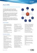
Control Your Territory ALS CWS ALS system Controller Working Position display module AIS ALS CWS provides controllers with clearly structured display of the air traffic situation integrating the surveillance data and the flight data. The position data are received from the tracker and displayed in the main and the secondary radar window, together with other aircraft information on a background of color maps of Area of Interest (AoI). REC METEO, LOCATORS, OPERATORS FLIGHT PLAN DATA HAND-OFF PROCEDURE The flight plans are received from FDPS and displayed as fully customizable electronic strips. ALS CWS automatically matches the flight plans to the tracks. HAND-OFF PROCEDURE COUPLED DATA MAIN FEATURES • A simple, well-arranged and easyto-integrate module, which displays all necessary air traffic information for ATCOs. • Wide configurability allows easy HMI adjustments according to the client’s needs. • User configuration of HMI features, e.g. colors, display layout, electronic strip classification. private maps directly from the workstation. • Accessible Mapper – a SW tool for map creating and maintenance. • Built on the latest technologies of picture processing (OpenGL) – smooth, no need for special HW, standard PC is sufficient. • Basic tools for archive data evaluation. • Creating and displaying of so-called • Tactical Tool – the utility cooperating with FDP system and providing the list of possible critical flight conflicts based on evaluation of flight plans (points they will fly over). • CWS independent of the FDP system – entering FPL directly. • Intercommunication among several CWS (without the server). • In case of critical system outage, hard-copy of e-strips is available. TECHNICAL DETAILS • Electronic strips display (paper as an alternative). • Display of the analogue primary radar data and meteorological data. • ASTERIX input format. • Analogue information of the primary radar is displayed after scan convector processing. • Display of multi-radar surveillance data of the aircraft position (tracks and plots). • Provides hand-off and automatic coordination within the system or with cooperating ATC workstations • Flight plan data display. • Choice of displayed maps, scales, and other parameters. • Display of the surveillance situation in the main or secondary radar window, with the feature of selected area detailed view. • Automatic or manual coupling of surveillance information with flight plan data. • Display of Safety Nets subsystem warnings. • Data congestion resistant. • Replay feature for archived system data together with basic evaluation tools. • Communication with FDP (Flight Data Processing) – flight plan data display and editing. • Display of the radio-goniometer output directly in the view display (VDF). • Communication with AIS (Aeronautical Information System) – meteorological information, designated area activat
Open the catalog to page 1All CS SOFT A.S. catalogs and technical brochures
 RADARDATA DISTRIBUTOR
1 Page
 ATC SIMULATOR & 3D TWR
1 Page
 ALS Tracker
1 Page
 ATC Simulator
1 Page
 FDPS
FDPS2 Pages
 ATC Validation
1 Page
 COTOOL
1 Page
 RADARVIEW
2 Pages
 TeeTRACK
3 Pages
 ALS CWS
1 Page


