GéoTITAN®

GéoTITAN®
GéoTITAN® is a sophisticated tool for designing instrument flight procedures, focusing on flight paths and their protection areas within a geo-referenced aeronautical environment. It utilizes reference data and a Digital Terrain Model to identify significant obstacles and compute safe altitudes, and is used in over 45 countries worldwide.
GéoTITAN® integrates ENAC PANS-OPS expertise with CGX's GIS knowledge, offering a comprehensive geo-referenced package for procedure designers. It aligns with Aeronautical Data Quality (ADQ) standards set by Eurocontrol Regulation and ICAO Annex 15 Amendment 37.
The software includes its own aeronautical database and can connect to external databases, including AIXM. It automatically analyzes the impact of database changes on designed procedures.
GéoTITAN® adheres to ICAO recommended practices as outlined in DOC 8168-OPS/611, DOC 9613, and DOC 9905. It uses Digital Terrain Models and aeronautical obstacle databases for automated analysis and computation of Minimum Obstacle Clearance Altitude (MOCA) and Obstacle Clearance Altitude (OCA).
GéoTITAN® can create conventional or RNAV/PBN trajectories, Annex 14 surfaces (OLS), circling, or the CRM. All computations are performed using the WGS-84 coordinate system.
The tool is based on a Geographical Information System (GIS) that manages scanned maps, DTM files, and procedure design working files. It displays aeronautical data such as aerodromes and navaids, and projects data to relevant coordinate systems.
A dedicated module designs procedures based on the PBN manual with high automation. It computes complete protection areas for various applications (e.g., B-RNAV, RNAV-1, RNAV-2, RNP approach) and manages transitions between applications.
While most designs are automated, CAD tools are available for situations where regulations cannot be applied.
Procedures can be exported to Data4Flight® for automated ARINC coding, chart publication, 3D visualization, and validation. Reports compatible with Microsoft Word can be generated for CRM studies or design reports. The Procedure Design Suite® includes solutions like Data4Flight® and AIP-GIS Charting® for chart production and publication, interoperable with AIXM-compliant systems.
Catalog excerpts

GéoTITAN® is an expert instrument flight procedure design tool for designing flight paths associated with their protection areas, in a geo-referenced aeronautical environment. Using the reference data and a Digital Terrain Model, GéoTITAN® identifies the most significant obstacles and automatically computes the safe altitudes. The solution is operated worldwide in more than 45 countries. GéoTITAN Adopted worldwide.
Open the catalog to page 1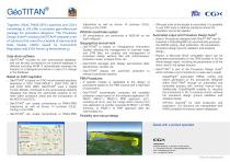
Together, ENAC PANS-OPS's expertise and CGX's knowledge in GIS offer a complete geo-referenced package for procedure designers. The Procedure Design Suite® including GeoTITAN® proposes a set of solutions that meet the schedule of Aeronautical Data Quality (ADQ) issued by Eurocontrol Regulation and ICAO Annex 15 Amendment 37. Data-driven software ® > GeoTITAN includes its own aeronautical database, and can be also connected to an external database in different including AIXM. It automatically analyses the impacts on a designed procedure in case of a change in the database. Based on ICAO regulation >...
Open the catalog to page 2All CGX catalogs and technical brochures
 OES
OES2 Pages
 ODYSSEE®
2 Pages
 Sat4Flight®
2 Pages
 AiRFInder®
2 Pages