
- Catalogs
- Brican Flight Systems
- TD100 Product Sheet

TD100 Product Sheet

TD100 Product Sheet
The ARIM320 is a weather-sensing solution designed for cost-effective, efficient, and safe collection of local weather conditions using remotely piloted aircraft systems. It provides mission-critical data to ground personnel via satellite telemetry. The system is capable of precise wind measurement, requiring high accuracy in airspeed, flow direction, and true heading. The ARIM320 is integrated into a lightweight package with a pressure boom and sealed electronics.
TD100E & M Microclimatology Mission Configuration
This configuration uses a high-performance composite aircraft platform with an electric motor and LiPo batteries, allowing for approximately 4 hours of flight. It includes a modified ARIM320 sensor suite, enabling real-time data review and interaction via an online interface. This allows for dynamic mission adjustments based on real-time feedback.
Payload Description
The ARIM320 system measures various air data parameters such as static pressure, total pressure, airspeed, altitude, angles of attack and sideslip, and air temperatures. It uses aerodynamic, meteorological, GPS, and inertial measurements, processed through an Extended Kalman Filter algorithm, to provide detailed data including airframe attitude, true heading, and three-dimensional winds. The system is fully integrated into a single enclosure within the aircraft fuselage.
Benefits
- Real-time measurement of winds and turbulence metrics.
- Provides temperature, humidity, and pressure data.
- Outputs high-precision aircraft attitude data.
- Fully integrated, FAA certified weather sampling solution.
- Supports aerodynamic calibration for efficient data analysis.
- Excellent price-performance ratio for meteorological observation.
- Can be integrated with other systems or operate independently.
Applications
- Aerial pesticide application support.
- Atmospheric observation for research.
- Airborne observation and pollution transport studies.
- Environmental parameter acquisition for remote sensing data analysis.
Aircraft Specifications
- Composite Carbon Fibre Air Frame
- Wing Span: 16' 3" (488.95 cm)
- Length: 6' 7" (200.25 cm)
- Electric Motor: 4.5 hp, 995 gram
- Power Supply: 8 x 37 V, 4500 mAh LiPo batteries
- Dry Weight: 34.6 lbs (15.7 kg)
- Max Weight: 50 lbs (22.7 kg)
- Max Speed: 120 mph (193 kph)
- Cruise Speed: 75 mph (120 kph)
- Endurance: 4 hrs (E), 30 hrs (M)
- Maximum Altitude: 14,763 feet (4,500 meters)
- Operating Temperature: -40° C to 45° C (-40° F to 113° F)
Catalog excerpts

Brican Flight Systems TD100E - Meteorological Survey / Weather Mapping Product Overview Using commercial aircraft can be expensive, using remotely piloted aircraft systems to gather local weather conditions aloft can tremendously cost effective, efficient, and safe. The ability to accurately define and forecast such local conditions depends on the quality of available upper-air data. Because of this, local weather measurements are required to determine weather forcasts. The ARIM320 is a weather-sensing solution for measuring mission-critical data, which is able to deliver that data to ground personnel using satellite telemetry. Accurate wind measurement from an airborne platform poses a challenging problem given the fact that the aircraft is moving many times faster than the wind being measured. As a result, the wind signal of interest is only a small portion of the measured air-motion data and is dominated by the motion of the aircraft itself. Under these circumstances, precision wind measurement to an accuracy better than 0.5 m/s (1 knot) requires acquisition of the true airspeed to better than 0.7 knots accuracy, flow direction (sideslip) to better than 0.1 degree accuracy and true heading to better than 0.2 degree accuracy. The ARIM320 system delivers this level of performance in a small, integrated, light-weight package that is easy to calibrate with the pressure boom molded directly into the airframe and the electronics safely sealed within the electronics bay. The TD100E & M Microclimatology Mission Configuration uses Brican’s high performance composite aircraft platform fitted with an electric motor and LiPo batteries for extended duration flight of approximately 4 hours in the air. The TD100 aircraft carries a modified version of Aventech’s ARIM320 Digital Air Probe sensor suite. The climatology payload package provides the user with the ability to review and react to sampled data in real-time via an online interface (in the form of a Ground Station readout). This will allow the Ground Station Operator to interact with the aircraft in-situ and add additional waypoints based on real-time data feedback and therefore re-task or extend the scope of the mission or survey area while the aircraft is still in flight. Payload Description The ARIM320 is an air data measurement system capable of providing: - Static Pressure (Ps) - Total Pressure (Pt) - Indicated Air Speed (IAS) / Altitude (IA) - Calibrated Air Speed (CAS) / Altitude (CA) - True Air Speed (TAS) / Altitude (TA) - Equivalent Air Speed (EAS) / Altitude (EA) - Angle of Attack (AOA) - Angle of Sideslip (AOS) - Total Air Temperature (TAT) - Outside Air Temperature (OAT) - And Impact Pressure The ARIM320 evaluates the parameters listed above from a base set of aerodynamic, meteorological, GPS code and carrier-phase, and inertial measurements which include: - Pitot Pressure - Static Pressure - AOA Differential Pressure - AOS Differential Pressure - Temperature - Humidity - GPS Time - GPS Position (Latitude, Longitude, and Altitude) - GPS Velocity - Three-axis Accelerations (X, Y, Z) - Three-axis Rates (Roll, Pitch, Yaw) Combining the GPS carrier-phase information with the acceleration and rate information using Aventech’s proprietary Extended Kalman Filter (EKF) algorithm subsequently provides: - Airframe Attitude (Roll, Pitch, Yaw) - True Heading (TH) - Course Heading (CH) - Three-Dimensional Winds. Integrated inertially-aided GPS attitude system provides: - Aircraft Attitude (Roll, Pitch, and Yaw) - Inertial Velocity - Wind Speed and Wind Direction - Rate of Climb (ROC) - Flight Path Angle (FPA) The air-data, GPS, inertial sensors and all analog and digital processing electronics are all fully integrated into a single miniature Air Data Probe enclosure which is mounted within the fuselage of the airframe. The probe only requires power in, and provides all acquired air data measurements via a digital communications interface.
Open the catalog to page 1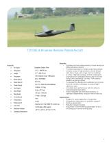
Aircraft • Air Frame • Wing Span • Power Supply • Dry Weight • Max Weight • Max Speed • Cruise Speed • Auto Pilot • Maximum Altitude 75 mph (120 kph) 4 hrs 30 hrs Spektrum 2.4 GHz DSM2 RC control sys 14,763 feet (4,500 meters) -40° C to 45° C (-40° F to 113° F) Applications • Support for aerial application of pesticides • Atmospheric observation for scientific research • Airborne observation • Pollution transport studies • Acquisition of environmental parameters to aid in the analysis of remote sensing data Provides real-time measurement of mean winds and RMS...
Open the catalog to page 2All Brican Flight Systems catalogs and technical brochures
 Brican Brochure
2 Pages