

NavPath

1 / 2 PagesView full catalog
NavPath
Product catalog summary
Overview: NavPath is a versatile flight planning tool designed for Unmanned Aerial Systems (UAS). It combines advanced features with a user-friendly interface to facilitate rapid and efficient flight plan development, even in remote locations without internet access.
Key Features:
- Waypoint and Geo-Fence Management: Allows for both auto-generation and manual editing of waypoints and geo-fences, providing fine-grained control over flight plan parameters.
- Disconnected Operation: Enables flight plan development without an internet connection, ideal for remote missions.
- Multiple UAS Compatibility: Supports various UAS platforms, enhancing flexibility.
- 3D Visualization: Offers a three-dimensional view of flight plans for better planning and analysis.
- GIS Reference Data Loading: Facilitates route definition by integrating agricultural or infrastructure data.
- U.S. Airspace Boundary Definition: Ensures compliance with airspace regulations.
- Flight Preview and Playback: Allows users to assess flight plan viability and sensor coverage before execution.
Workflow:
- Load Reference Data: Import relevant data to aid in route planning.
- Create Waypoints: Define waypoints manually or automatically based on reference data.
- Define Profiles: Organize waypoints into profiles for complex flight plans.
- Select UAS & Define Commands: Choose the UAS and assign commands to waypoints.
- Establish GeoFence: Set flight and safety boundaries.
- Preview Flight & Export Plan: Review the flight plan and export it for use with the UAS.
Contact Information: Bihrle Applied Research Inc., 81 Research Drive, Hampton, VA 23666 USA. Phone: +1 757.766.2416, Email: [email protected]
See more
Catalog excerpts
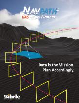
Flight Planner Data is the Mission. Plan Accordingly.
Open the catalog to page 1
Flight Planner NavPath is a UAS-agnostic flight planning tool that combines advanced features with a flexible and intuitive user interface. NavPath is designed to meet the need for rapid flight plan development while retaining fine-grained control over flight plan parameter definitions. This is accomplished through the auto-generation of waypoints and geo-fences while allowing manual definitions and point-by-point editing capabilities. Additionally, NavPath provides the option for disconnected flight plan development, in the absence of an internet connection, for operation in remote locations....
Open the catalog to page 2All Bihrle catalogs and technical brochures
 compARE
2 Pages
 SimGen
2 Pages
 UAS Modeling & Simulation
2 Pages
 DSix
DSix3 Pages
 StallBox
2 Pages
*Prices are pre-tax. They exclude delivery charges and customs duties and do not include additional charges for installation or activation options. Prices are indicative only and may vary by country, with changes to the cost of raw materials and exchange rates.
About AeroExpo
AeroExpo is a marketplace that offers B2B players a complete experience, from product sourcing to purchase. AeroExpo is an entity of VirtualExpo Group.
Are you a buyer?
Are you a supplier?