Catalog excerpts

VIS Line Scanner Visible Line Scanner APPLICATION • Airborne Remote Sensing in the visible wavelength range • Detection of features on the sea surface such as oil spills, chemical plumes and biogenic slicks • Acquisition of highly resolved geo-referenced RGB composite images • Documentation of the oil spill scene Visible remote sensing of marine pollution using the VIS Line Scanner The OPTIMARE VIS Line Scanner has been established as a supplementary tool for various airborne remote sensing applications, like for example airborne maritime surveillance. The VIS Line Scanner is a ruggedized, lightweight remote sensor for earth observation at visible wavelengths. In maritime surveillance, the system is used for acquisition of highly resolved geo-referenced Red/ Green/Blue composite images. These images can be used for documentation and for more exact volume estimations based on oil appearance codes.
Open the catalog to page 1
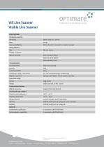
VIS Line Scanner Visible Line Scanner SPECIFICATION Mechanical properties Dimensions VIS Line Scanner is connected to a mission computer Optical detectors Type Spectral sensitivity Scanning Systems Scanning method Across-track scanning Line rate Instantaneous Field of View (IFOV) Typically 1,000 ft (higher altitude operation possible) Power/Fuel supply Current Communication/Interface Network connection Copper or fiber-optic ethernet Operating/Storage conditions Ground survival temperature Operating temperature RTCA/DO-160G, Section 8, Category S, Curve L (random) Standards Environmental...
Open the catalog to page 2All AERODATA AG catalogs and technical brochures
-
RNAV FI System AD-RNAV
4 Pages
-
AeroFIS®
8 Pages
-
RNAV FI System AD-RNAV
4 Pages
-
PRICE LIST 2017
8 Pages


