カタログの抜粋

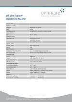
VIS Line Scanner Visible Line Scanner APPLICATION • Airborne Remote Sensing in the visible wavelength range • Detection of features on the sea surface such as oil spills, chemical plumes and biogenic slicks • Acquisition of highly resolved geo-referenced RGB composite images • Documentation of the oil spill scene Visible remote sensing of marine pollution using the VIS Line Scanner The OPTIMARE VIS Line Scanner has been established as a supplementary tool for various airborne remote sensing applications, like for example airborne maritime surveillance. The VIS Line Scanner is a ruggedized, lightweight remote sensor for earth observation at visible wavelengths. In maritime surveillance, the system is used for acquisition of highly resolved geo-referenced Red/ Green/Blue composite images. These images can be used for documentation and for more exact volume estimations based on oil appearance codes.
カタログの1ページ目を開く
VIS Line Scanner Visible Line Scanner SPECIFICATION Mechanical properties Dimensions VIS Line Scanner is connected to a mission computer Optical detectors Type Spectral sensitivity Scanning Systems Scanning method Across-track scanning Line rate Instantaneous Field of View (IFOV) Typically 1,000 ft (higher altitude operation possible) Power/Fuel supply Current Communication/Interface Network connection Copper or fiber-optic ethernet Operating/Storage conditions Ground survival temperature Operating temperature RTCA/DO-160G, Section 8, Category S, Curve L (random) Standards Environmental...
カタログの2ページ目を開くAERODATA AGのすべてのカタログと技術パンフレット
-
AeroFIS®
8 ページ
-
PRICE LIST 2017
8 ページ


