Estratti del catalogo

GéoTITAN® is an expert instrument flight procedure design tool for designing flight paths associated with their protection areas, in a geo-referenced aeronautical environment. Using the reference data and a Digital Terrain Model, GéoTITAN® identifies the most significant obstacles and automatically computes the safe altitudes. The solution is operated worldwide in more than 45 countries. GéoTITAN Adopted worldwide.
Aprire il catalogo a pagina 1
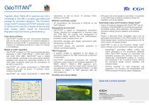
Together, ENAC PANS-OPS's expertise and CGX's knowledge in GIS offer a complete geo-referenced package for procedure designers. The Procedure Design Suite® including GeoTITAN® proposes a set of solutions that meet the schedule of Aeronautical Data Quality (ADQ) issued by Eurocontrol Regulation and ICAO Annex 15 Amendment 37. Data-driven software ® > GeoTITAN includes its own aeronautical database, and can be also connected to an external database in different including AIXM. It automatically analyses the impacts on a designed procedure in case of a change in the database. Based on ICAO...
Aprire il catalogo a pagina 2Tutti i cataloghi e le schede tecniche CGX
-
OES
2 Pagine
-
ODYSSEE®
2 Pagine
-
Sat4Flight®
2 Pagine
-
AiRFInder®
2 Pagine


