Extraits du catalogue
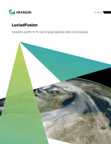
LuciadFusion Scalable platform for serving geospatial data and analysis
Ouvrir le catalogue en page 1
LuciadFusion is a scalable platform for geospatial data management and publication. You can set it up for users to manage their data intelligently, store and process a multitude of data formats and feed data to numerous applications. Features including powerful automatic cataloging and quick and easy data publishing allow you to design, portray, process and set up advanced maps in a few simple clicks. These are just a few examples of why users turn to LuciadFusion to solve their geospatial data challenges: LuciadFusion Studio is an included browser application that provides you with a...
Ouvrir le catalogue en page 2
Connect to over 200 data formats Add custom formats, styling and analytics Rely on full OGC open standards support Manage data dynamically Connect to any database Work with domain-specific formats and standards Serve Earth observation multispectral imagery directly Handle dynamic 4D data, such as weather data Connect natively to over 200 data formats Bring in new custom formats easily with LuciadFusion’s API Include military symbology - APP6 and MS2525 Add custom styling Create new services for: • Data • Symbologies • Custom data processing and analysis Serve any data over open standards...
Ouvrir le catalogue en page 3
Practical information Connecting to LuciadFusion services can be done from: • OGC-compliant browser applications, built on LuciadRIA or other platforms Desktop applications, built on LuciadLightspeed, LuciadCPillar or other platforms Mobile applications, built on LuciadCPillar for Android or other platforms Figure 2: LuciadFusion offers intuitive data management for non-GIS specialists.
Ouvrir le catalogue en page 4
Overview LuciadFusion components are organized into product tiers. Depending on the needs of your organization, you can opt for LuciadFusion Essential, Advanced or Pro. In the Advanced and Pro tiers, powerful, extended functionality is available to you with extra options. Core GIS engine Projection, datum and geoid models Transformation and projection engine 4D cartesian and geodesic geometry model Unified data model Customizable styling Raster connectors Vector connectors Feature included CPU, GPU image processing image Optional feature Point clouds and reality meshes OGC standards OGC...
Ouvrir le catalogue en page 5
Functional specifications Below is a high-level, non-exhaustive overview of the functionality available in LuciadFusion. You can use the functionality it offers out of the box or extend it to meet user-specific requirements. Projection, datum and geoid models Transformation and projection engine 4D cartesian and geodesic geometry model Unified data model Customizable styling Raster connectors Vector connectors Access and represent data in any coordinate reference system (geodetic, geocentric, topocentric and grid) and in any projection Perform advanced geodetic calculations, transformations...
Ouvrir le catalogue en page 6
CPU, GPU image processing image Point clouds and reality meshes Connect to, visualize and serve unlimited point clouds and reality meshes Serve pre-tiled and multilevel point cloud data as optimized OGC 3D tiles or HSPC stream Get out-of-the-box native support for: • OSGB, LAS, LAZ, E57, HSPC or OGC 3D Tiles and supporting Draco compression Connect to several OGC web services, and read data in a variety of OGC formats Get support for these standards, formats and services: • OGC CSW, GeoPackage, GML, KML, WCS, WFS(-T), WMS, WMTS, OGC Filter 2.0 (Spatial filter capabilities can be enabled...
Ouvrir le catalogue en page 7
Symbology services Use a service to provide full sets of military symbology icons with icon styling specifications • The same icons across your system are available on the map and other UI components • This requires the Defense Symbology option Centrally organize, manage and serve all your geospatial data and styles from the LuciadFusion Studio web application, regardless of the data format Allow clients to discover data through an OGC CSW catalog and query data based on the ISO metadata profile or your custom metadata attributes Control access to your data (also via products and services)...
Ouvrir le catalogue en page 8
Real-time engine Database connectors Optimally connect to and serve dynamic data Pre-render, convert or relay data streams; includes capabilities to translate and forward data streams in any format, such as the web-friendly GeoJSON format Perform analytics on real-time data Add support for connecting to and serving data directly from spatial databases Get support for these database formats: • IBM DB2, Informix Geodetic and Spatial Datablade, OGC GeoPackage, Oracle Locator and Oracle Spatial, PostGIS (PostgreSQL spatial database extension), SAP HANA (Beta), Microsoft SQLServer and SQLite...
Ouvrir le catalogue en page 9
Infrastructure standards Get support for these formats: • Autocad DWG/DXF, Microstation DGN, Hexagon Binz, IFC and Autodesk Revit Model, render and serve aeronautical data such as airspaces, navaids, procedures and grid minimum off route altitudes (MORAs); integrate with operations from the Advanced GIS Engine This includes options for custom styling Get support for these formats: • AIXM (3.3, 4.0, 4.5, and 5.1), ARINC 424 and DAFIF(T) Integrate the various military data formats at your disposal for full situational awareness Get support for these formats: • ADRG, ASRP, BCI, CADRG, CIB,...
Ouvrir le catalogue en page 10
Figure 3: Using LuciadFusion Studio, you can serve large vector datasets on-the-fly, with OGC SE filtering and styling applied automatically. You can set up data services in a few clicks, including domain-specific formats like AIXM5.1, NVG or S-57. Figure 4: LuciadFusion can be extended with additional analysis services, for example a service offering remote LOS calculations.
Ouvrir le catalogue en page 11
Figure 5: Visualization and analysis of multi-dimensional weather data in LuciadLightspeed Lucy, served by LuciadFusion as multidimensional WMTS. Figure 6: LuciadFusion can connect to, optimize and serve unlimited point clouds and reality meshes.
Ouvrir le catalogue en page 12
More information LuciadFusion comes with: • Ready-to-use LuciadFusion Studio application Guided user tours In-application help within LuciadFusion Studio Ready-to-use tiling engine application (DCM) with end-user guide Developer’s guide with clear explanations and descriptions of best practices API reference offering detailed descriptions of all interfaces and classes Code samples for all components Build scripts, Maven POM files and sample servlets for easy project setup and deployment Release notes to see what’s new Technical notes to support technical requirements To learn more or...
Ouvrir le catalogue en page 13Tous les catalogues et fiches techniques (PDF) HEXAGON METROLOGY SAS
-
GeoMedia
12 Pages
-
LuciadLightspeed
12 Pages
-
LuciadRIA
9 Pages
Catalogues archivés
-
Leitz PMM-C
16 Pages
-
AT960
2 Pages

