Extractos del catálogo

HA T-R. Height Above Terrain-Radar EIT Avionics developed the Height Above Terrain Radar (HAT-Rtm) to improve safety by providing pilots with the ability to receive real-time height above terrain (HAT) data, manifold pressure, and vertical speed. HAT-Rtm is an add-on module for the ESAID® system from EIT Avionics. The data is displayed to show height above terrain to enhance ground proximity awareness. HAT-Rtm uses proprietary technology to capture and display altitude information to the pilot. HAT-Rtm provides the following measurements for helicopter operation: Height Above Terrain Vertical Speed Indicator Manifold Pressure HAT-Rtm allows for real-time monitoring and display of flight information to improve pilot awareness and flight safety. HA T-R in a Robinson R44Contents subject to modification.
Abrir la página 1 del catálogo
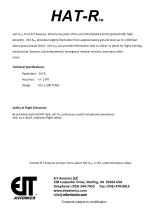
HAT-Rtm/ from EIT Avionics, informs the pilot of the aircraft's distance to the ground with high accuracy. HAT-Rtm provides height information from approximately ground level up to 1,500 feet above ground level (AGL). HAT-RTm can provide information that is critical to pilots for flight training, aerial patrol, forestry, law enforcement, emergency medical services, and many other areas. Technical Specifications: Resolution: 0.5 ft. Accuracy: +/-1.6 ft Safety of Flight Enhanced: By providing real-time HAT data, HAT-Rtm enhances a pilot's situational awareness and, as a result, improves...
Abrir la página 2 del catálogoTodos los catálogos y folletos técnicos EIT Avionics
-
Brochure ESAID
2 Páginas


